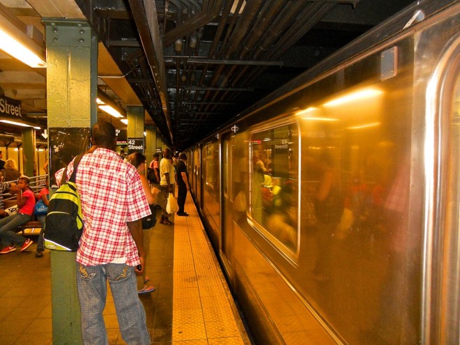
New York City has one of the most extensive transit systems in the world, which makes getting around the huge metropolis convenient and cheap. But with 24 subway lines, a complex bus system, varied schedules and regular service interruptions, traversing the city can be confusing. One of the best ways to learn your way around is by walking, especially with one of our expert-guided walking tours. But if you want to go it alone there are a number of mobile apps that provide detailed directions and up-to-the-minute transit information to make your journey relatively easy.
Here are our picks for best mobile apps to navigate New York.
NYC Navigation Apps
- City Mapper – provides start-to-finish journey planning with real-time information on subways, busses, ferries and bikes across all five boroughs. The app also provides information on service disruptions and will alert you when to get off the bus. You can personalize the app with frequently visited places. Available for IOS & Android. Free
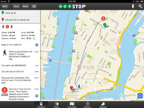
- Transit App – this app tells you about nearby transit options and departure times. See real-time status of trains or buses and the trip planner helps you plot the best route. Available for IOS & Android. Free
NYC Subway Apps
-
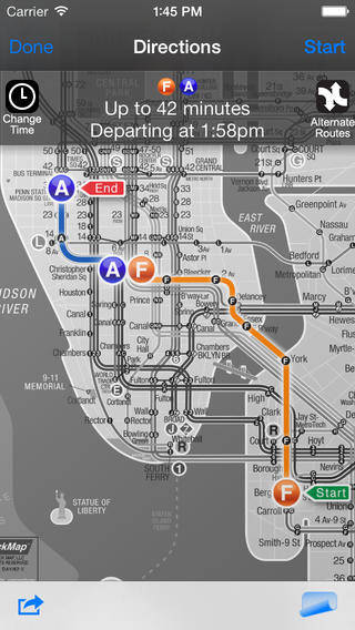
The KickMap App makes navigating the subway easy. Embark NYC – This app works as a trip planner and sends schedule updates based on MTA service changes and advisories without an internet connection. It also offers a handy subway map. Available for iPhone, iPad, iPod touch. Free
- MTA Subway Time – produced by the MTA, this app gives you real-time train arrival information for select subway lines and the Staten Island Railroad. The app will let you know of service delays or reroutes before you pay your fare and lessens waiting time on platforms (particularly handy on sweltering summer days). Available for iPhone, iPad, iPod touch. Free
- NYC Subway 24-Hour KickMap – this app provides an NYC subway map and directions without an internet connection, a pop-up Google street map, a GPS locator for finding the closest subways stations, customized transit alerts and identifies stations with no free cross-over to go in the opposite direction. Available for iPhone, iPad, iPod touch. $2.99
Apps for NYC Buses, Bikes and Trains
- NYC Bus Checker – gives you real-time arrival information for each bus, route maps, live CitiBike dock info, disruptions, and travel tips. NYC Bus Checker will even wake you up when you get to your bus stop. Available for iPhone and Android devices. Free
-
Citibike’s app is essential for biking NYC. Bus NYC – provides live departure and arrival data for all bus routes, full timetables for selected routes, service advisories, bus route maps and trip planners. Many of the app’s features also function without Wi-Fi. Available for iPhone, iPad, iPod touch. $2.99
- Get There By Bike – this app offers directions for cyclists that account for traffic, hills and local off-street bike paths. Bike boulevards, lanes and routes are also included. You can record your own routes and mark dangerous intersections, safe bike parking options and bike-friendly businesses on the shared map as well. Available for iPhone, iPad, iPod touch. $2.99
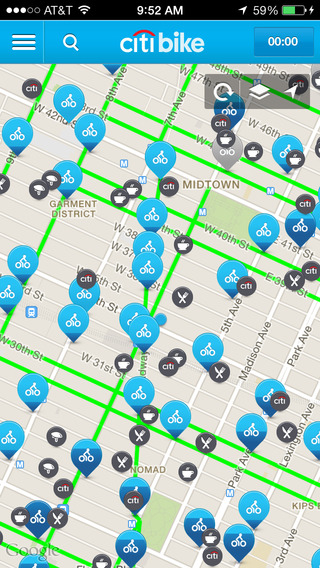
- Citibike – the official app for the city’s huge bike-sharing program, it provides locations of the 332 stations, bike availability, route planning and details about businesses and attractions near each station. Available for IOS & Android. Free
- MTA Train Time: Metro-North & LIRR – produced by the MTA, this apps allows you to track your train and provides live, up-to-date schedules. Users can find nearby stations and receive alerts about service delays to select lines. Available for IOS & Android. Free
Here’s a brief video we’ve created, featuring New Yorkers sharing their favorite apps for navigating the city.
NYC Taxi Apps
- Cab Sense NYC – analyzing data from the NYC Taxi and Limousine Commission, this apps help you find the best nearby street corners to hail a taxi based on the day, time and your location. The app even comes with a built-in “cab hailer”—simply shake your phone and it will whistle and display a flashing message. Available for IOS & Android. Free
-
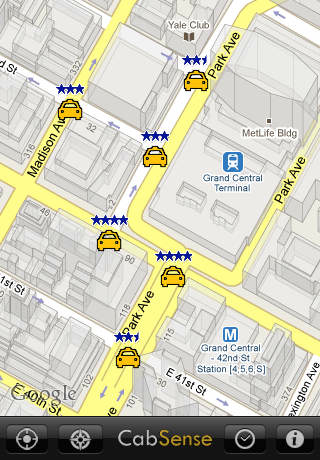
CabSense gives you the edge in nabbing a taxi. Uber – the official app for the car-service system of independent drivers. Get a fare quote, connect with your driver via the automated system, get route information and an ETA. Available for IOS & Android. Free
Apps for NYC Drivers
- MTA Bridges and Tunnels Drive Time – produced by the MTA, this app tells you how traffic is moving at NYC’s bridges and tunnels. Tap the name of a bridge or tunnel to see the crossing time. You can also see how long it’s taking to get from these crossings to other important local destinations. Available for IOS & Android. Free
- BestParking – helps you find the cheapest and most convenient parking facilities. It also offers coupon discounts at hundreds of parking facilities, NYC’s on-street regulations (every street’s signs are decoded and included in the calculation engine), and prepaid reservations at all NYC airports. Available for IOS, Android and Blackberry. Free
Honorable Mention…
Arts for Transit – this app provides information about the wide variety of permanent artwork installed throughout NYC’s subway and rail system. You can find artwork listed by line or by artist, get directions to the installations, read information about the work and artist, see photos and listen to podcasts. Available for IOS & Android. Free
Wanderboat – this site provides an AI-based travel planning tool for inspiration, building your itinerary, and creating a perfectly personalized trip for you. We think this is a great place to start and get ideas for your next NYC trip.
What’s your go-to app for navigating the city? Tell us in the comments below.